All about Racine, Wisconsin's long and interesting history
Water Street
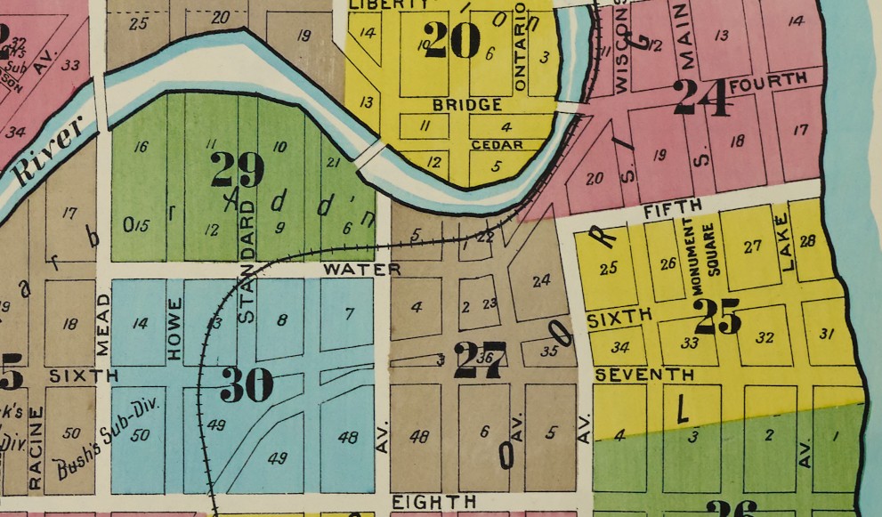
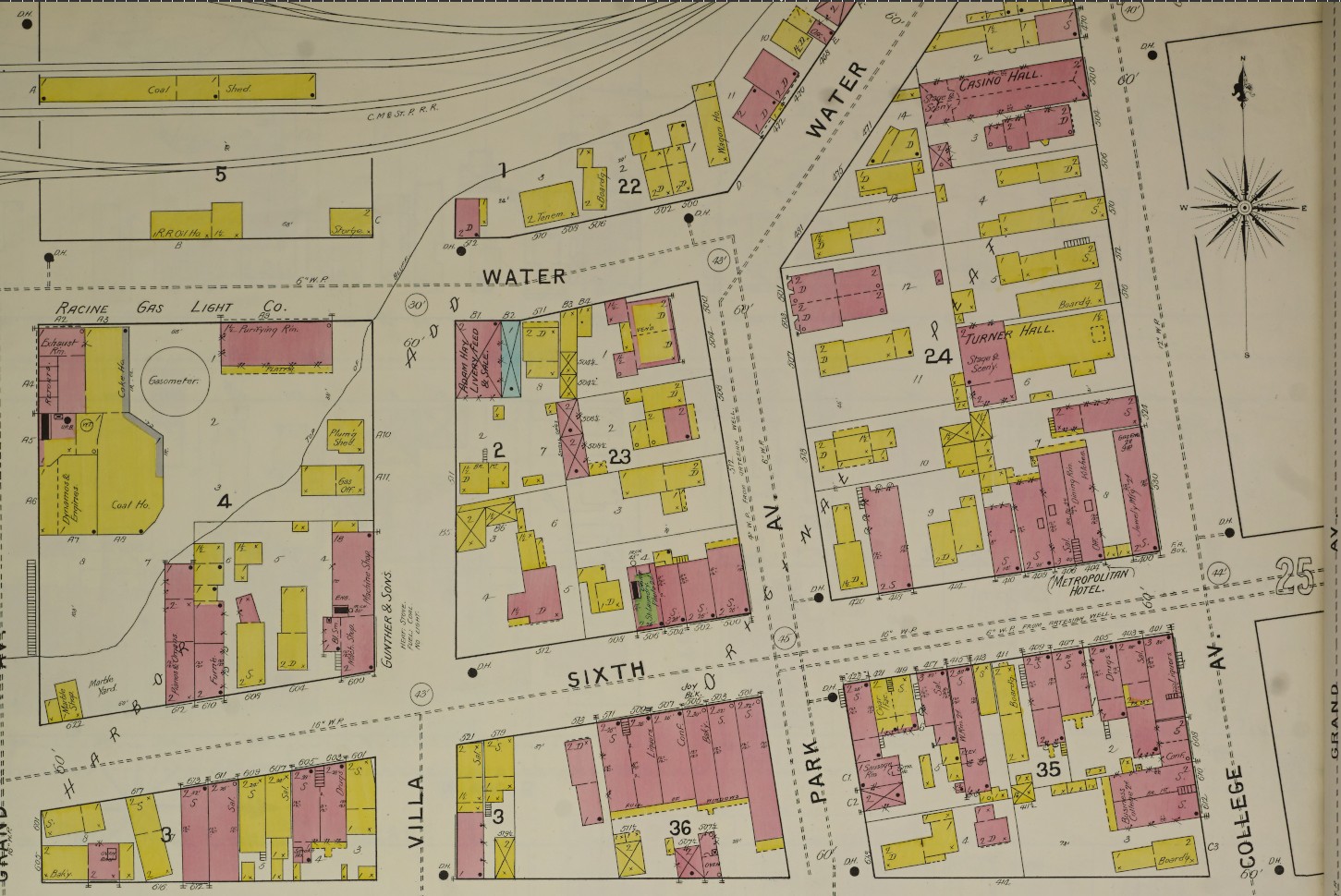
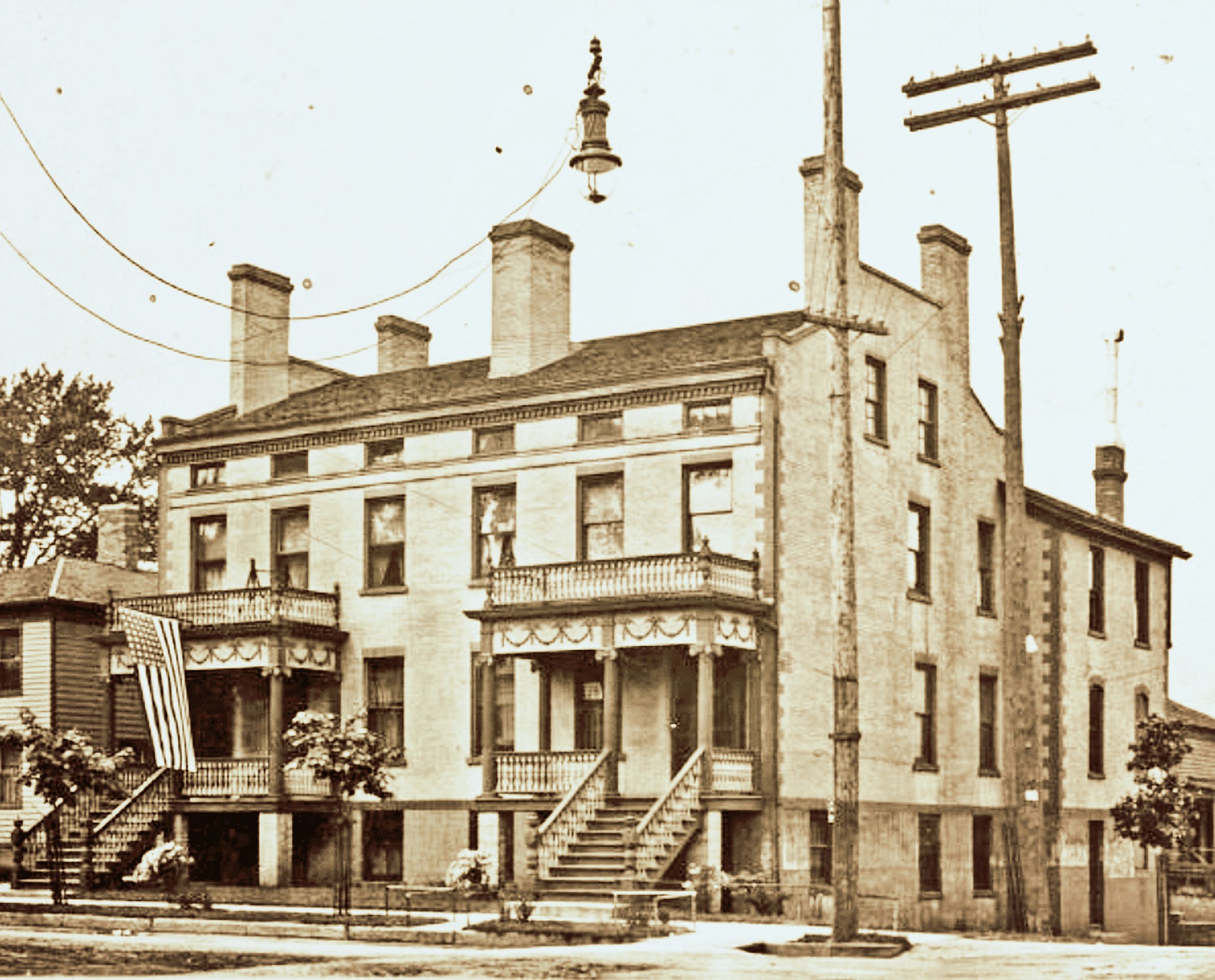
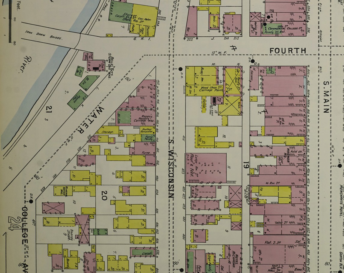
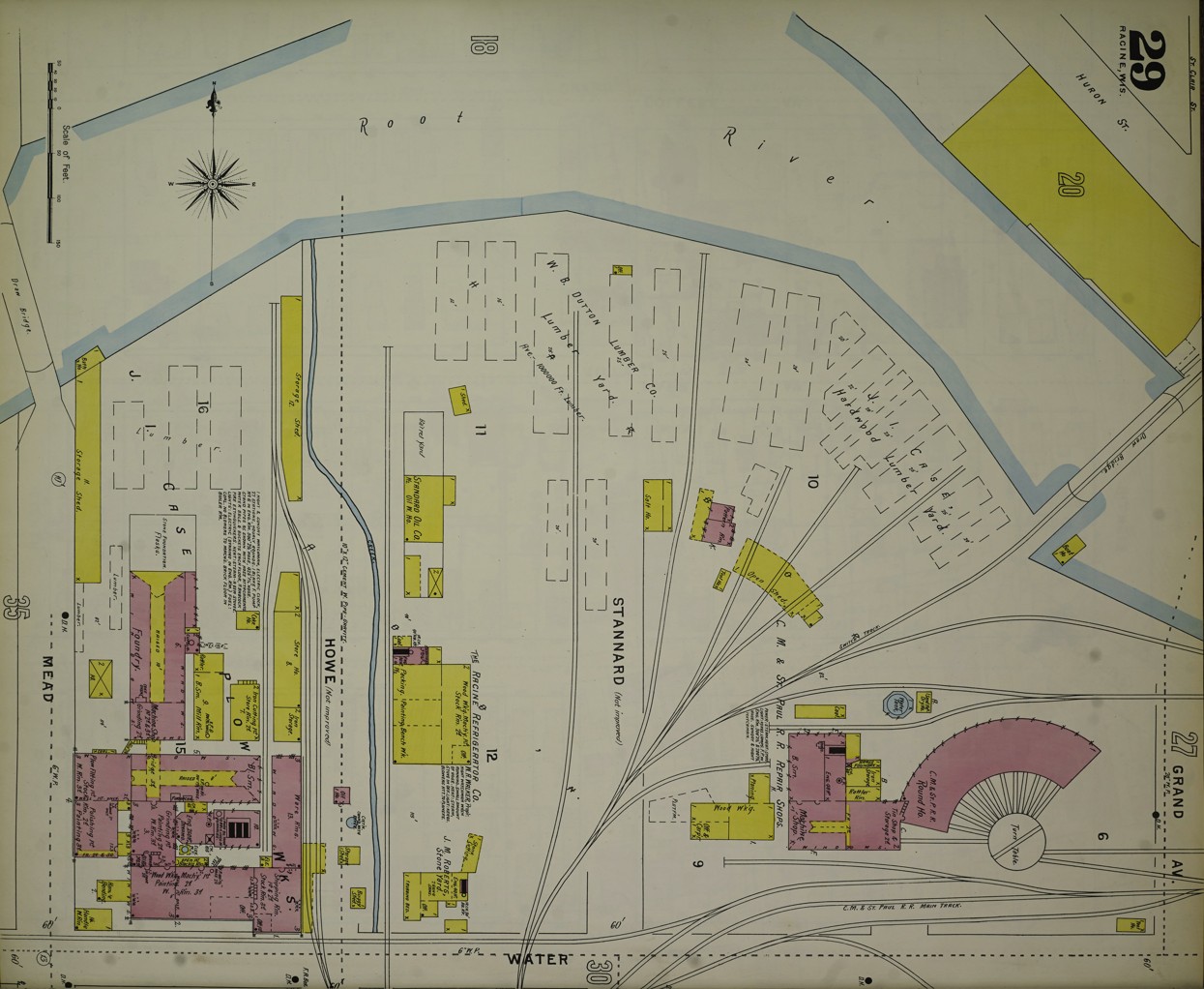
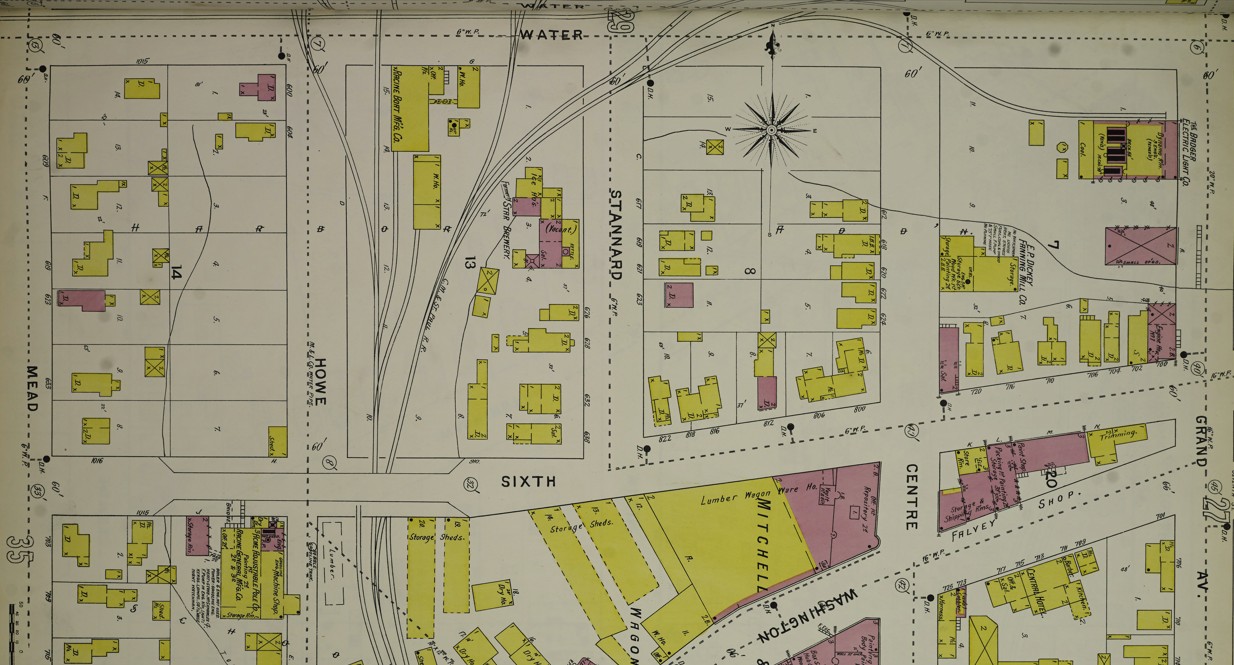
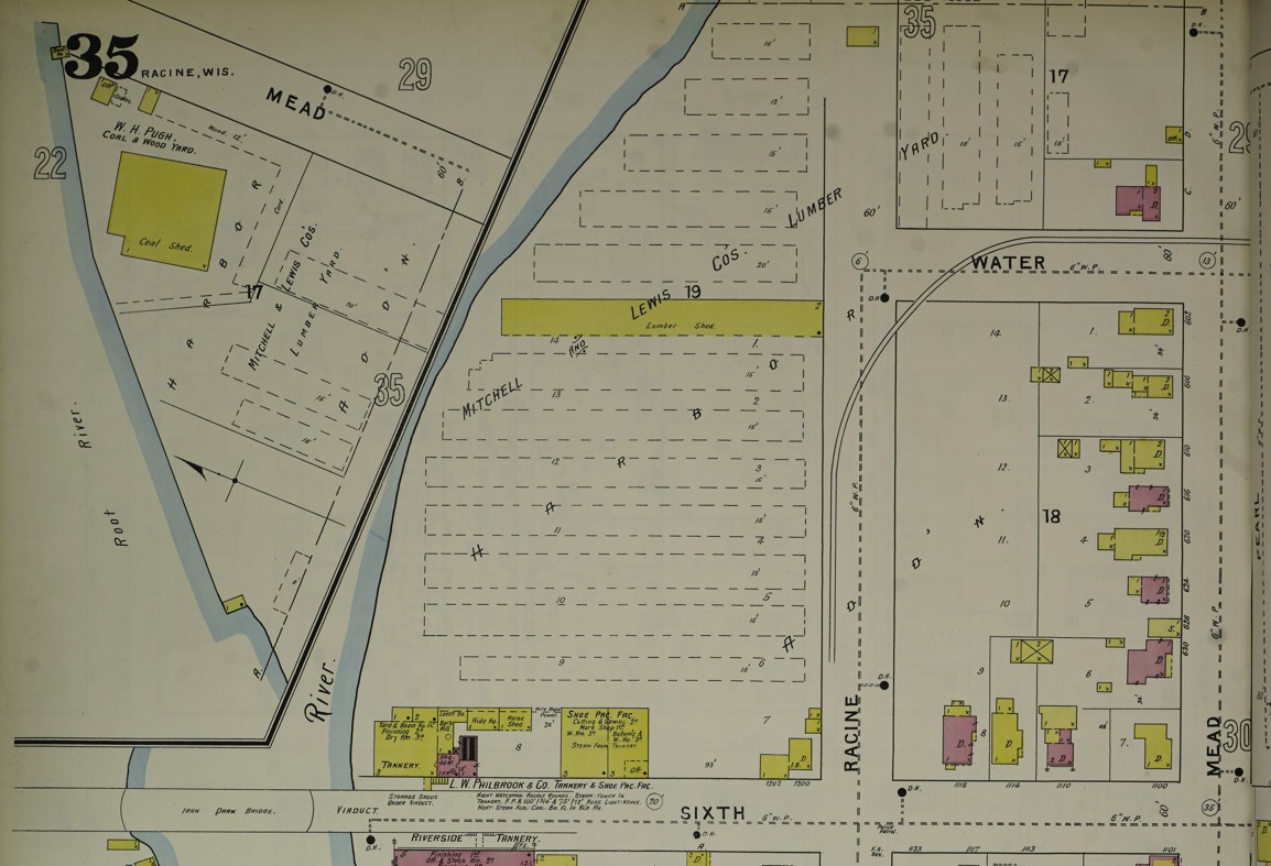
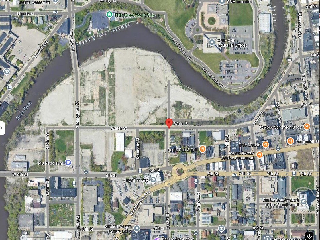
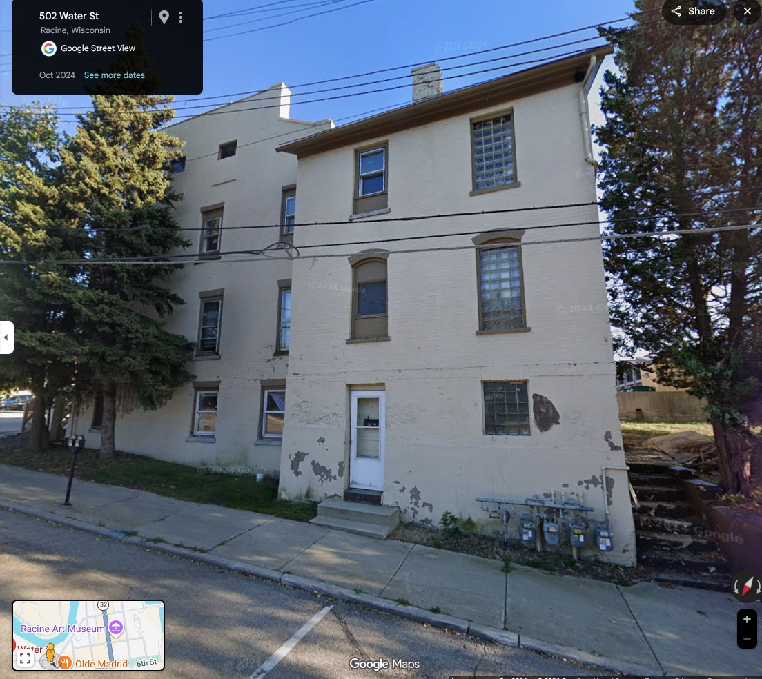
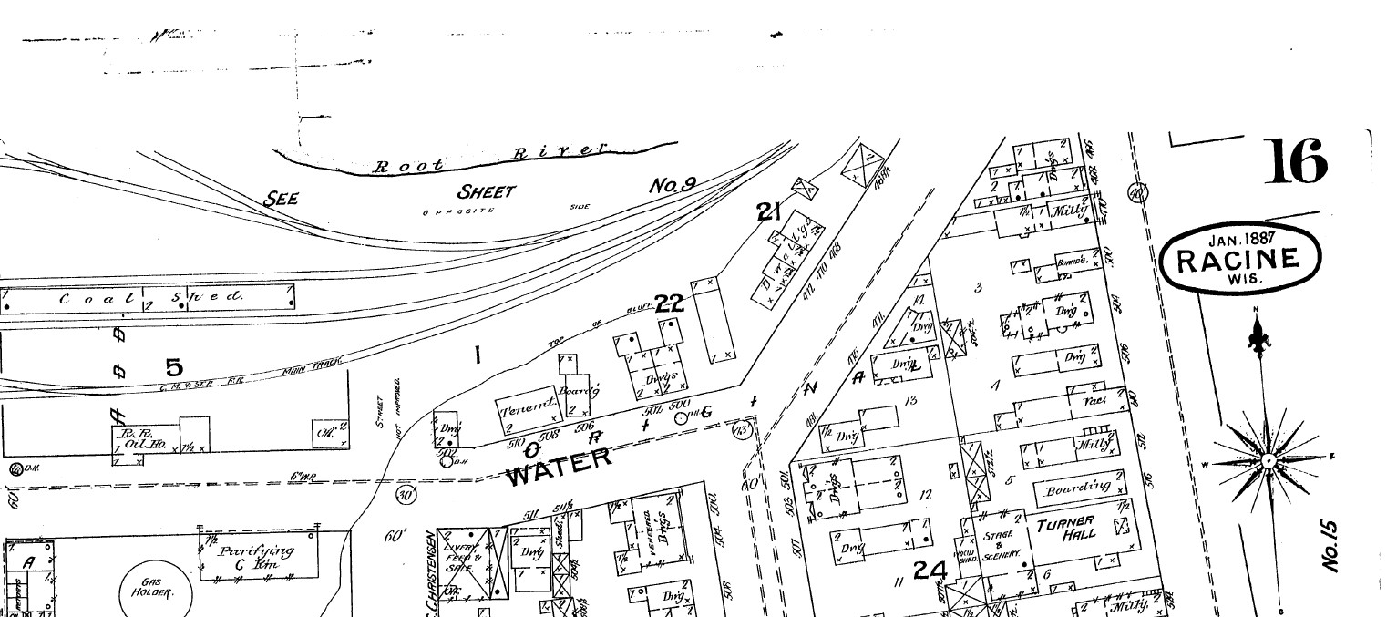
Water Street in Racine always struck me as a very old part of the city. This map showing Water Street is from the 1894 Sanborn insurance map.I am probably most familiar with the intersection of Water Street and Park Ave. and the duplex which served as a rectory for some time. Notice all the buildings that used to be between Water Street and the rail area to the north.500 and 504 Park Avenue, which sits at the corner of Park Avenue and Water Street. This photo is from Dennis Tully and is from about 1870.Here is the part of Water Street that continues northeast along the Root River and runs into 4th Street and South Wisconsin Ave. I have rotated this map so that north is at the top. From the 1894 Sanborn insurance map.Here is Water Street continuing west from Grand Ave. past Mead Street to Racine Street, showing all the factories between Water Street and the Root River. I have rotated this map so that north is at the top. From the 1894 Sanborn insurance map.From Dennis Tully: Here is the roundhouse shown on the Sanborn map above.Here is the south side of Water Street between Grand Ave. and Mead Street (now called S. Marquette) showing the Racine Boat Mfg. Co. and a somewhat more residential neighborhood compared to the factories on the north side of Water Street. I have rotated this map so that north is at the top. From the 1894 Sanborn insurance map.And finally, here is Water Street ending at Racine Street near the Mitchell and Lewis lumber yards. From the 1894 Sanborn insurance map.Compare this 2026 Google Maps image of Water Street to the 1894 maps and you can see that all of the factories and most of the apartments and boarding houses are gone. Mead Street is now S. Marquette Street in this area.This building right around the corner from 500-504 Park Avenue may or may not be a separate building. It appears to have the address of 503 Water Street, but the 3 is missing from the sign. I can see by the gas meters that there are at least four units in this building, accessible by the stairs to the right.Look at these tiny houses marked “Dwell’gs” near the bold number 21 on this 1887 Sanborn map. 472, 470, and 468 Water Street not only were tiny, but backed up against the railroad tracks. Can you imagine how noisy it would have been to live in these houses? The is the earliest mention of Water Street that I have found. I believe that Norris’s shop, at the “foot of Water street,” would have been near the intersection of what is now 4th Street and S. Wisconsin Avenue. Racine Advocate, February 8, 1843.J. M. Killup and M. G. Armor’s livery stable on Water street. Racine Advocate, May 28, 1844.