All about Racine, Wisconsin's long and interesting history
Racine Reef Lighthouse
The photos below are from the Great Lakes Lighthouse Keepers Association group on Facebook and are reposted here for preservation.
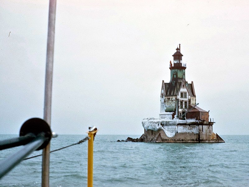
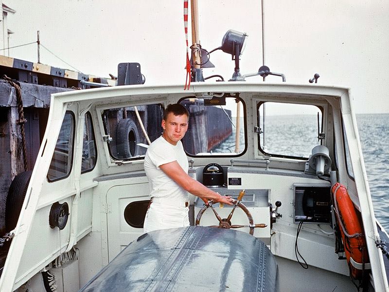
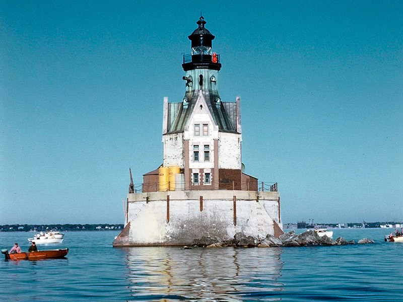
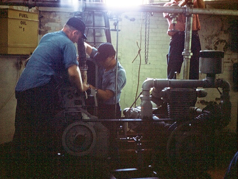
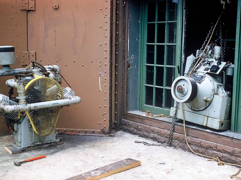
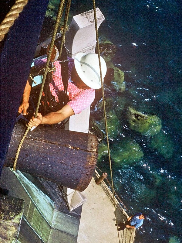
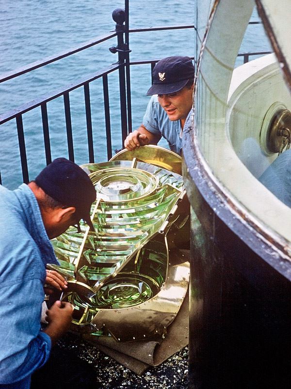
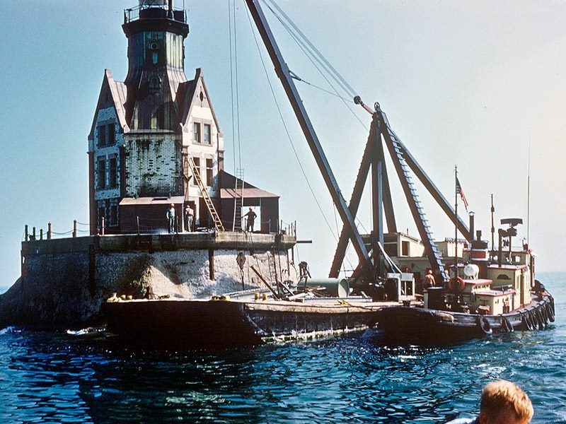
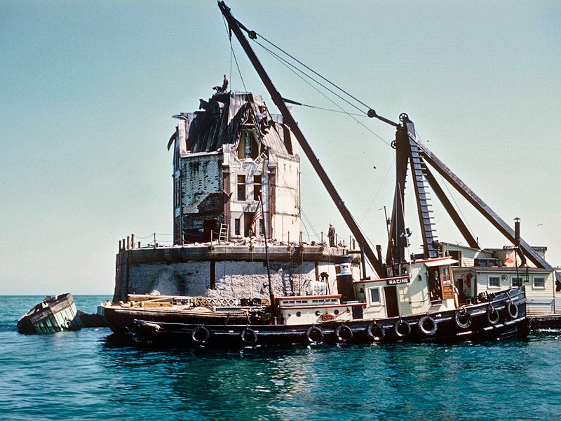
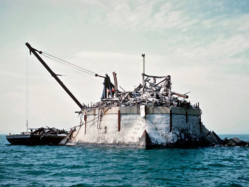
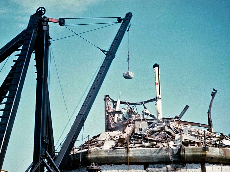
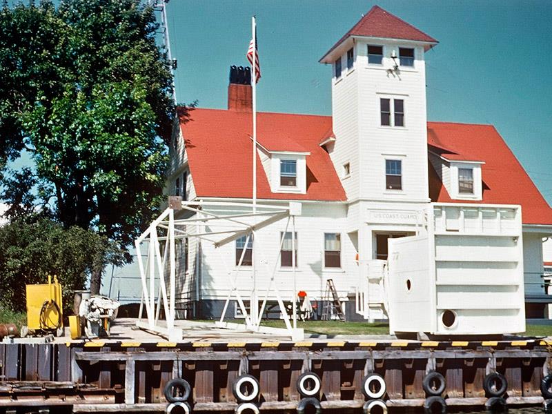
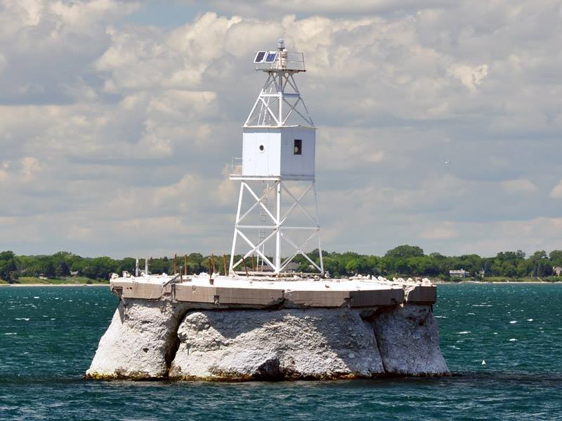
Approaching the ice-caked Racine Reef lighthouse at the beginning of the 1961 season of navigation. Photo by Jerry Schober — at 42°43’38.81″N, 87°44’09.77″W. — from Great Lakes Lighthouse Keepers AssociationJerry Schober at the helm, ready to depart Coast Guard Station Racine. The Coast Guard station was a combination of buildings formerly constituting the the former lifesaving station and the Racine pierhead lighthouse. Photo by jerry Schober. — at 42°35’19.75″N, 87°48’30.97″W.The Racine Reef lighthouse in early summer 1961. Evidently a popular place for local fishermen. Photo by Jerry Schober. — with Nikola Vrkić at 42°43’38.81″N, 87°44’09.77″W.1961 Racine Reef crew members work at removing the compressors and generators in the equipment room, preparing for the station’s demolition. Photo by Jerry Schober. — at 42°43’38.81″N, 87°44’09.77″W.One of the compressor and its diesel power unit are carefully hoisted from the equipment room to the deck at the Racine Reef light station in 1961. Photo by Jerry Schober. — at 42°43’38.81″N, 87°44’09.77″W.Coast Guard crew members removing the diaphone resonators from the tower at the Racine Reef light station in 1961. Photo by Jerry Schober. — at 42°43’38.81″N, 87°44’09.77″W.The view from the lantern gallery at Racine Reef light station as crew members prepare to lower the diaphone resonator down to the deck. Photo by Jerry Schober. — at 42°43’38.81″N, 87°44’09.77″W.Station Racine Reef crew members carefully prepare one of the lens panels from the station’s Fourth order lens for lowering down to the deck and transportation to shore. Photo by Jerry Schober. — at 42°43’38.81″N, 87°44’09.77″W.The US Army Corps of Engineers Tug RACINE and demolition barge pull up alongside the lighthouse. Note that the lighthouse crew have already stripped the crib deck of all storage tanks, cranes and equipment. Photo by Jerry Schober. — at 42°43’38.81″N, 87°44’09.77″W.In this 1961 photo, the tower, lantern and all additions to the crib level had been demolished, and work was about to begin on demolishing the roof. Photo by Jerry Schober. — at 42°43’38.81″N, 87°44’09.77″W.Demolition of the 1906 Racine Reef lighthouse by the Army Corps of Engineers is virtually complete in this photo, with only rubble remaining on the deck. Photo by Jerry Schober. — at 42°43’38.81″N, 87°44’09.77″W.The final few swings of the wrecking ball at the Racine Reef light station in 1961. Photo by Jerry Schober. — at 42°43’38.81″N, 87°44’09.77″W.The US Army Corps of Engineers tug RACINE and barge returning to the harbor at Racine with a load of demolished materials from the Racine Reef light station in 1961. Photo by Jerry Schober. — at 42°35’19.75″N, 87°48’30.97″W.The new skeletal aid to navigation structure was delivered to the Racine Coast Guard station, painted, and made ready for transportation out to the cleared crib at Racine Reef in 1961. Photo by Jerry Schober. — at 42°35’19.75″N, 87°48’30.97″W.The new 1961 aid to navigation structure atop the cleared Racine Reef crib as it appeared in 2010. — at 42°43’38.81″N, 87°44’09.77″W.
Even tho I was born in 1966 I fell in love with the Reefpoint Lighthouse. I wish they never would have demolished it!! It would’ve made a great AIR BNB!! They were very shortsighted!!


Heartbreaking
Even tho I was born in 1966 I fell in love with the Reefpoint Lighthouse. I wish they never would have demolished it!! It would’ve made a great AIR BNB!! They were very shortsighted!!